Precision Reality Capture for
engineering
digital twins
3D mapping
LiDAR scanning, aerial photogrammetry, and intelligent spatial data.
Request a Quote Explore ServicesAbout GeoVision Tech
Turning the Physical World into a Measurable Digital Asset
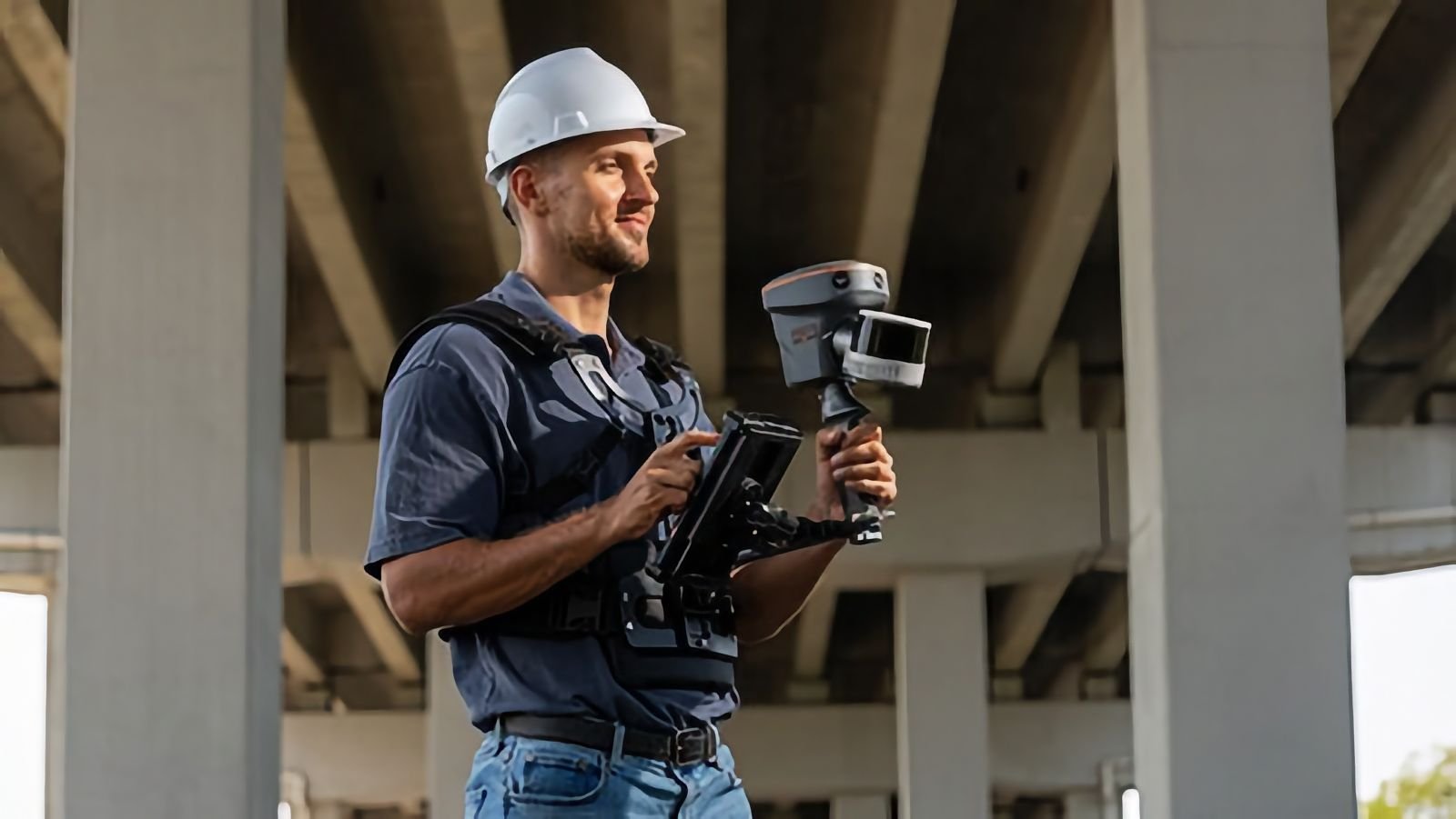
GeoVision Tech is a technology and engineering systems company, specializing in integrated end-to-end solutions for spatial mapping, surveying, and digital twin creation.
We provide a complete workflow for complex projects – from managing topographic and engineering surveys performed by certified surveyors, through 3D laser scanning (LiDAR) and aerial photogrammetry, to building BIM models and Geographic Information Systems (GIS).
Our goal is to help organizations transform physical environments into accurate, measurable, and smart digital assets — to improve planning, infrastructure management, and decision-making.
Our Technology, Your Field
Our core advantage lies in the synergy between hardware and execution. We utilize technologies such as 3D Gaussian Splatting, aerial photogrammetry, and SLAM laser scanning to deliver spatial data at a scale and precision level that was previously impossible.
Engineering & Surveying
Management and execution of surveying, licensing, and construction control projects, performed by a team of legally certified surveyors operating under the company's umbrella.
Integration & Equipment
Supply of GNSS/RTK receivers, mobile scanners, and advanced software systems, including cloud data processing platforms — for contractors, engineering firms, and authorities.
Municipal Development
Initiation and development of customized 3D C&C and GIS systems for smart infrastructure management, municipal assets, and advanced spatial analysis.
3D
Reality Capture
360°
Complete Spatial Models
Cutting-Edge
Technology
LiDAR, Drones & Advanced Photogrammetry
Millimeter
Precision
Maximum Resolution for Field Data Collection
Areas of Expertise
Our Services
Digital Twins
Creation of a precise digital replica based on rendered point clouds for planning, project management (BIM), and complex simulations in a 3D environment.
LiDAR-Based Scanning
Rapid, critically accurate 3D ground mapping for buildings, facades, terrains, and construction sites using high-end scanners, generating engineering workflow files.
Aerial Mapping & Photogrammetry
High-resolution spatial data collection using advanced mapping drones to create polygonal orthophotos, 3D models, and extensive site documentation.
Topographic & Engineering Surveying
Execution of valid field surveys by a certified surveyor, including the preparation of As-Made maps, registration plans, and precise earthwork volume calculations for planning and execution.
3D GIS Systems
Development and implementation of smart spatial information management platforms designed to streamline the work of local authorities, planners, and strategic infrastructure management bodies.
GeoVision Products
Hardware, Software & Cloud
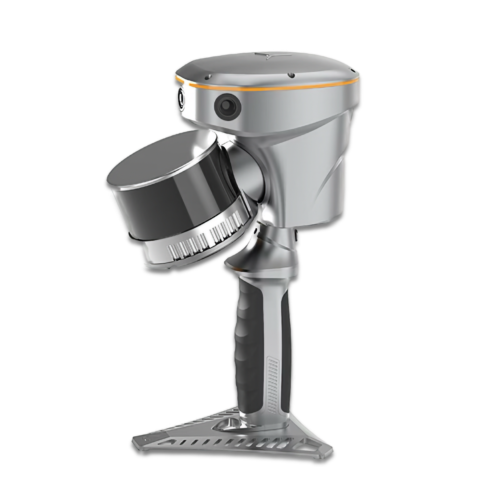 Hardware / 3D Scanners
High-end mobile scanning system (RTK+SLAM). Rapid indoor and outdoor mapping, generating high-accurate point clouds.
View Product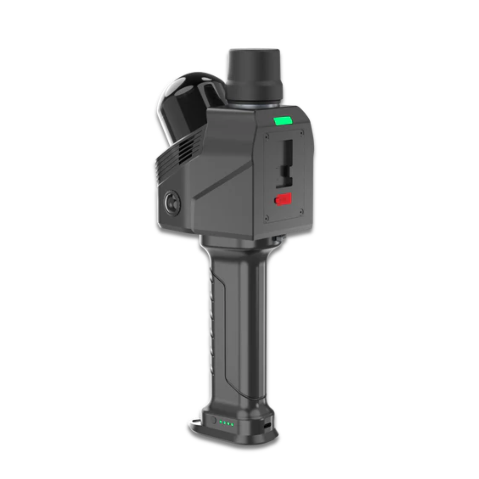 Hardware / 3D Scanners
Dynamic, portable 3D scanner. Optimized for complex indoor measurements, building documentation, and rapid engineering design processes.
View Product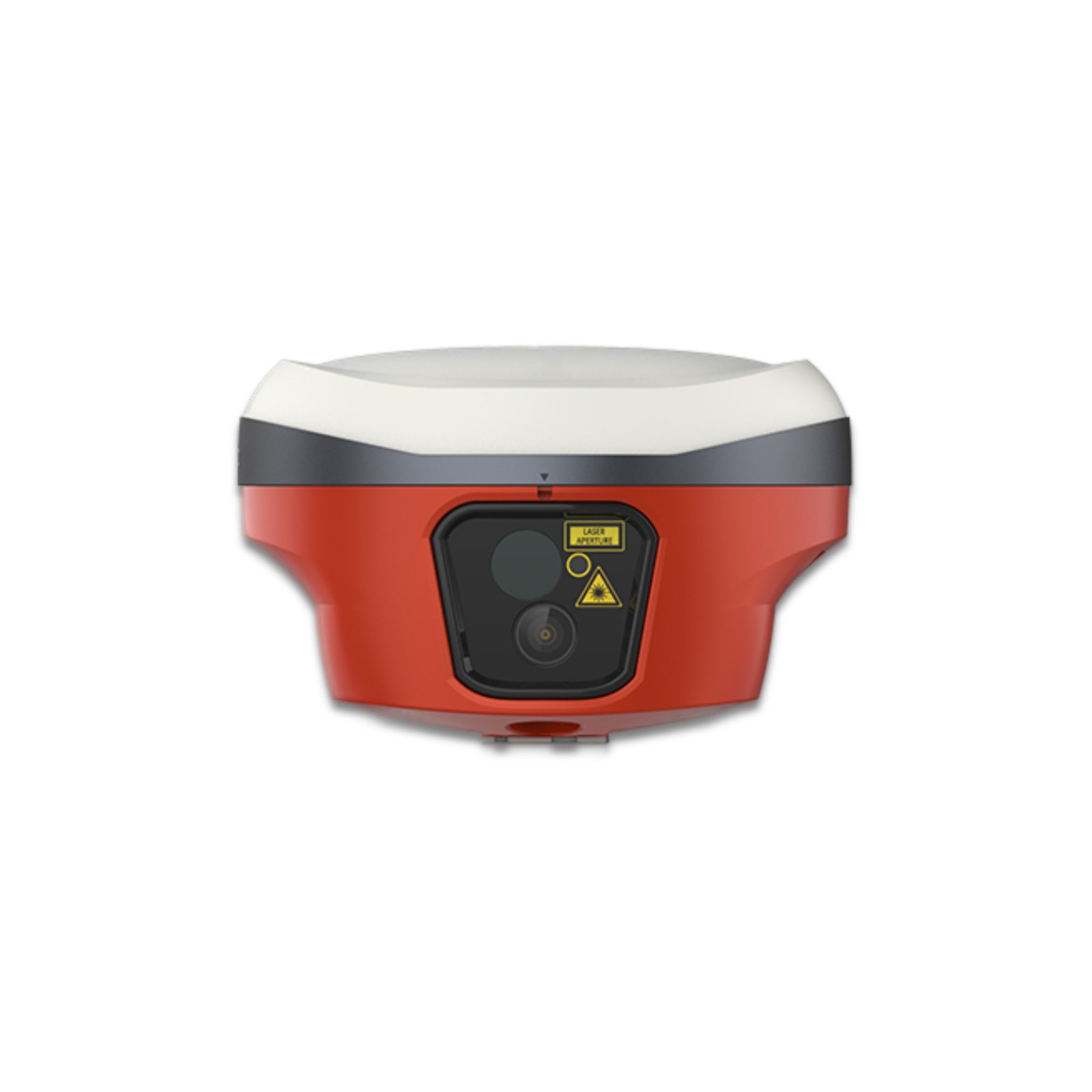 Hardware / GNSS Receivers
Smart, compact geodetic receiver. Maximum spatial accuracy, high reliability, and operational ease for daily survey environments.
View Product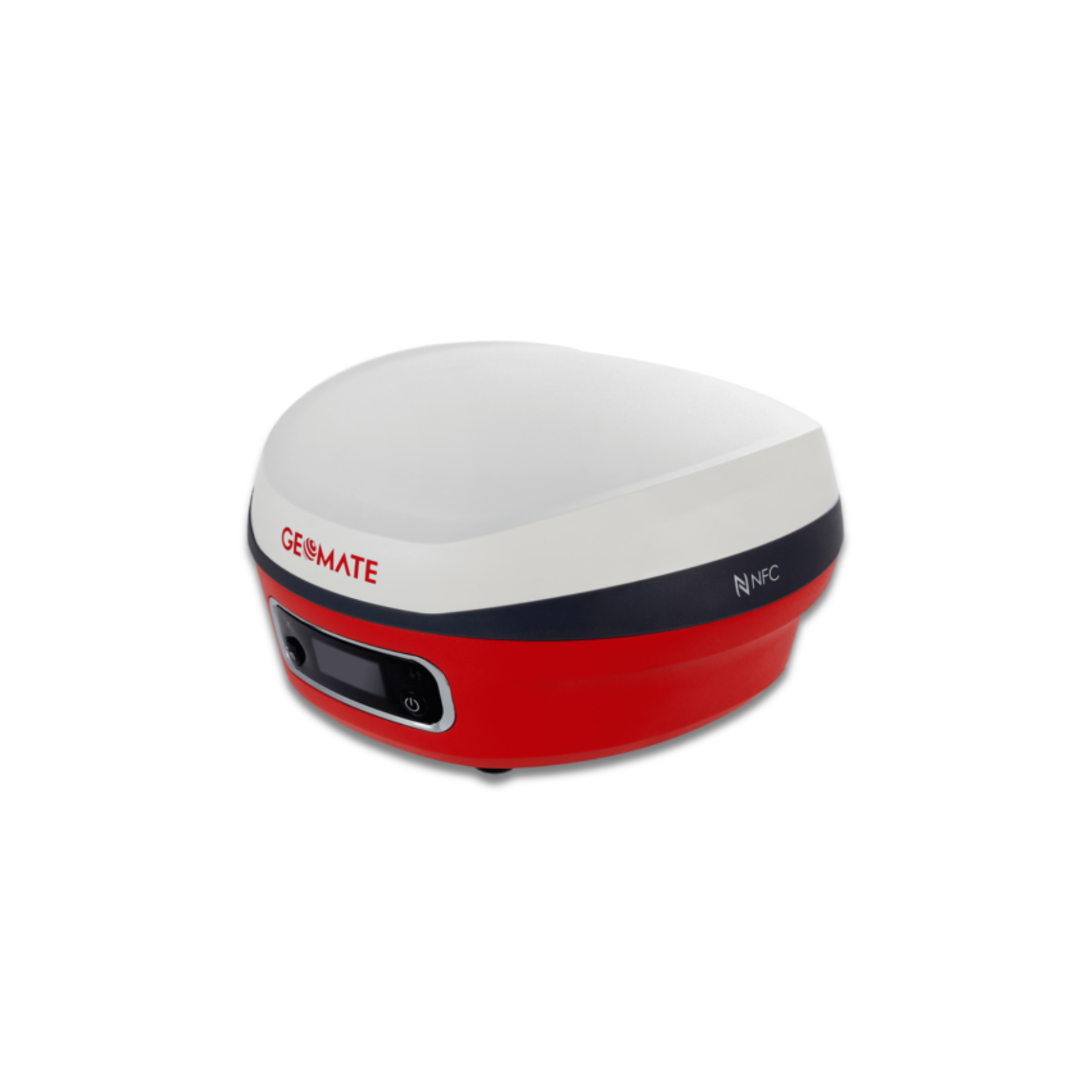 Hardware / GNSS Receivers
Advanced geodetic measurement system featuring IMU technology for tilt surveying without the need for leveling.
View Product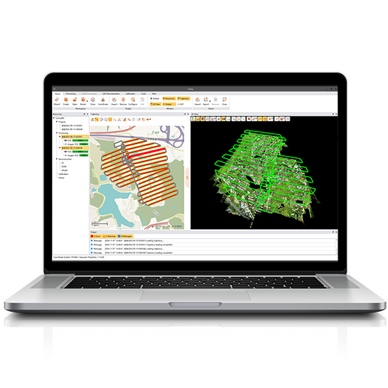 Software / Processing
Core software for scan data calibration and processing. Transforms raw data into accurate, colorized point clouds.
View Product Software / Processing
CAD and analysis platform for point clouds. Volume calculations, vector extraction, and generation of advanced maps and models.
View Product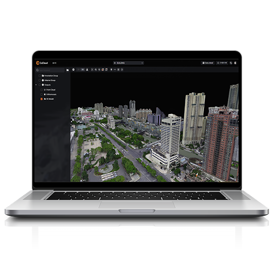 Software / Cloud
Cloud system for secure storage, processing, and online sharing of 3D models and point clouds.
View ProductRecent Projects
Immersive Virtual Tours (Matterport)
3D Virtual Tour: Private Residence Digital Twin
Real Estate Digital Asset: Residential Apartment
Spatial Visualization for Tourism: Golan Heights Resort Complex
Photorealistic 3D Modeling (3DGS)
Workflow
Engineering Work Methodology
Project Definition & Planning
Strict requirements definition. Terrain analysis, coordinate grid establishment, sensor selection, and definition of mapping resolution (LOD/LOA) alongside execution timelines.
Spatial Data Collection
Deployment of survey teams and high-end equipment (RTK receivers, LiDAR scanners, and photogrammetry drones). Massive and precise data collection ensuring strict safety protocols and real-time quality control.
Data Fusion & Processing
Ingesting raw data into processing systems. Performing sensor fusion, calibration, point cloud noise reduction, and generation of spatial models (DTM/DEM, polygonal orthophoto, 3DGS models).
Delivery of Engineering Deliverables
Supply of finalized deliverables. Delivery of As-Made situational maps, cloud-based digital twin models (CoCloud), detailed volume calculations, and standard compliance reports for ongoing planning.
Technologies
Tools We Work With





Tell Us About Your Project
We will get back to you as soon as possible.
Contact Details
For projects, scanning, mapping, or technical consultation.
Location
Majdal Shams, Israel